
AI MOBILITY PLATFORM
BUILDING A ROAD CONDITION INTELLIGENCE PLATFORM FROM CONCEPT TO SCALABLE SAAS
Overview
Smartroads AI is an infrastructure intelligence startup focused on evaluating road conditions using smartphone and advanced data processing techniques to estimate road roughness indicators such as the Estimated International Roughness Index (eIRI). <br/> The company approached us with a validated use case but without technical architecture, product design, or development foundations. Our team led the full product lifecycle - from ideation and geospatial data modeling to mobile application development and SaaS dashboard delivery.
Client: SmartRoads
Timeline: Sept 2025 - Sept 2024
Technology Used: TypeScript, Next.js, Android Native/Kotlin, PostgreSQL, GeoJSON, Shapefiles, Cloud Infrastructure
Industry: Mobility AI / Infrastructure Analytics
Challenge
Smartroads AI needed to transform a research-driven concept into a production-ready platform capable of supporting real-world road survey operations.
1. Product Foundations: The startup had no wireframes, user flows, or technical stack defined. A complete product strategy, system architecture, and UX framework had to be created from scratch.
2. Geospatial Complexity: Accurate road condition analysis required the creation of a proprietary road network model capable of mapping sensor data to real-world road segments. This involved processing and structuring geospatial data using GeoJSON and Shapefile formats.
3. Offline Data Collection: Road surveys often occur in remote areas with limited connectivity. The mobile application therefore needed to function fully offline while ensuring reliable data capture and synchronization.
4. Sensor Data Processing: Smartphone-based motion and GPS signals needed to be transformed into meaningful road quality indicators such as eIRI. This required robust data pipelines capable of handling continuous survey data streams.
5. SaaS Platform Requirements: The solution needed to support multiple organizations operating road surveys simultaneously. A scalable SaaS dashboard was required to allow users to create projects, manage survey teams, and analyze road condition results.

Solution
A structured product engineering approach was adopted to design and implement the Smartroads AI platform.
• Product Ideation & UX Design
• We defined core product workflows, user roles, and survey interaction models. Low- and high-fidelity prototypes were created to validate usability and ensure efficient field operations.
• Geospatial Architecture
• A road network infrastructure was designed and implemented to support spatial indexing and segmentation of survey data.
• GeoJSON and Shapefile processing pipelines enabled accurate mapping of collected sensor data to specific road segments.
• Offline-First Android Application
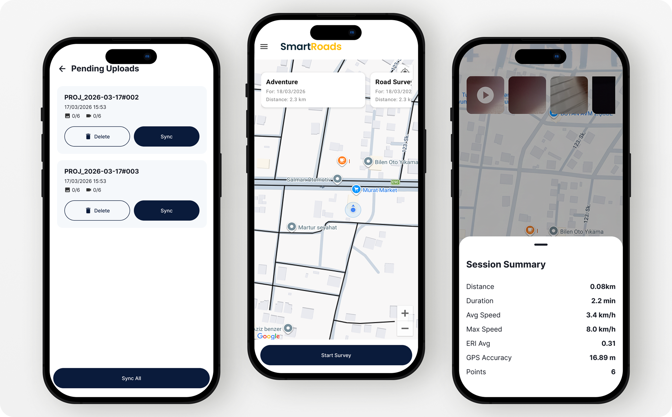
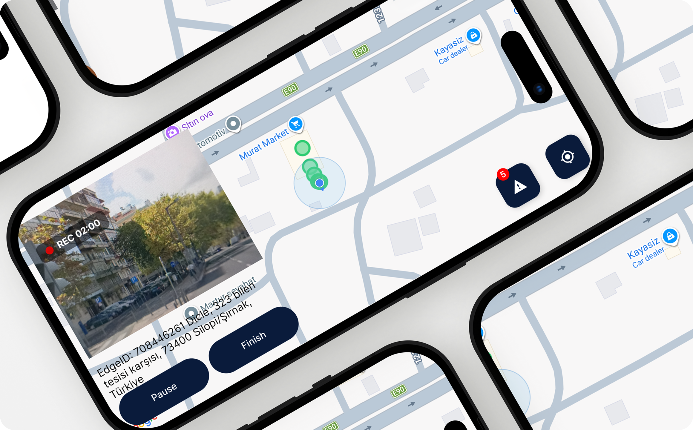
• A native Android mobile application was developed to collect motion sensor and GPS data during road surveys. The app was built with a fully offline-first architecture, allowing uninterrupted data collection and later synchronization when connectivity becomes available.
• SaaS Dashboard Development
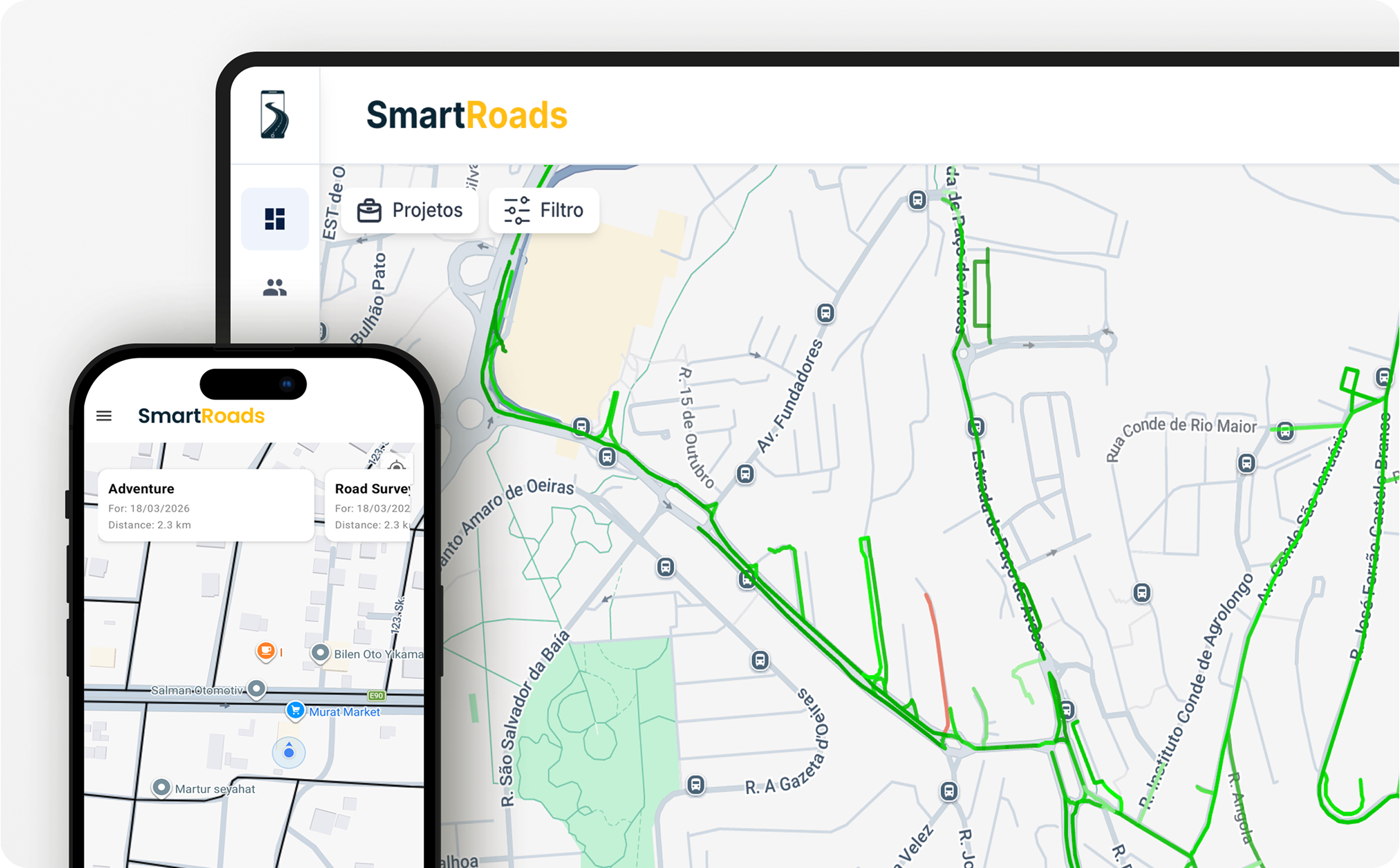
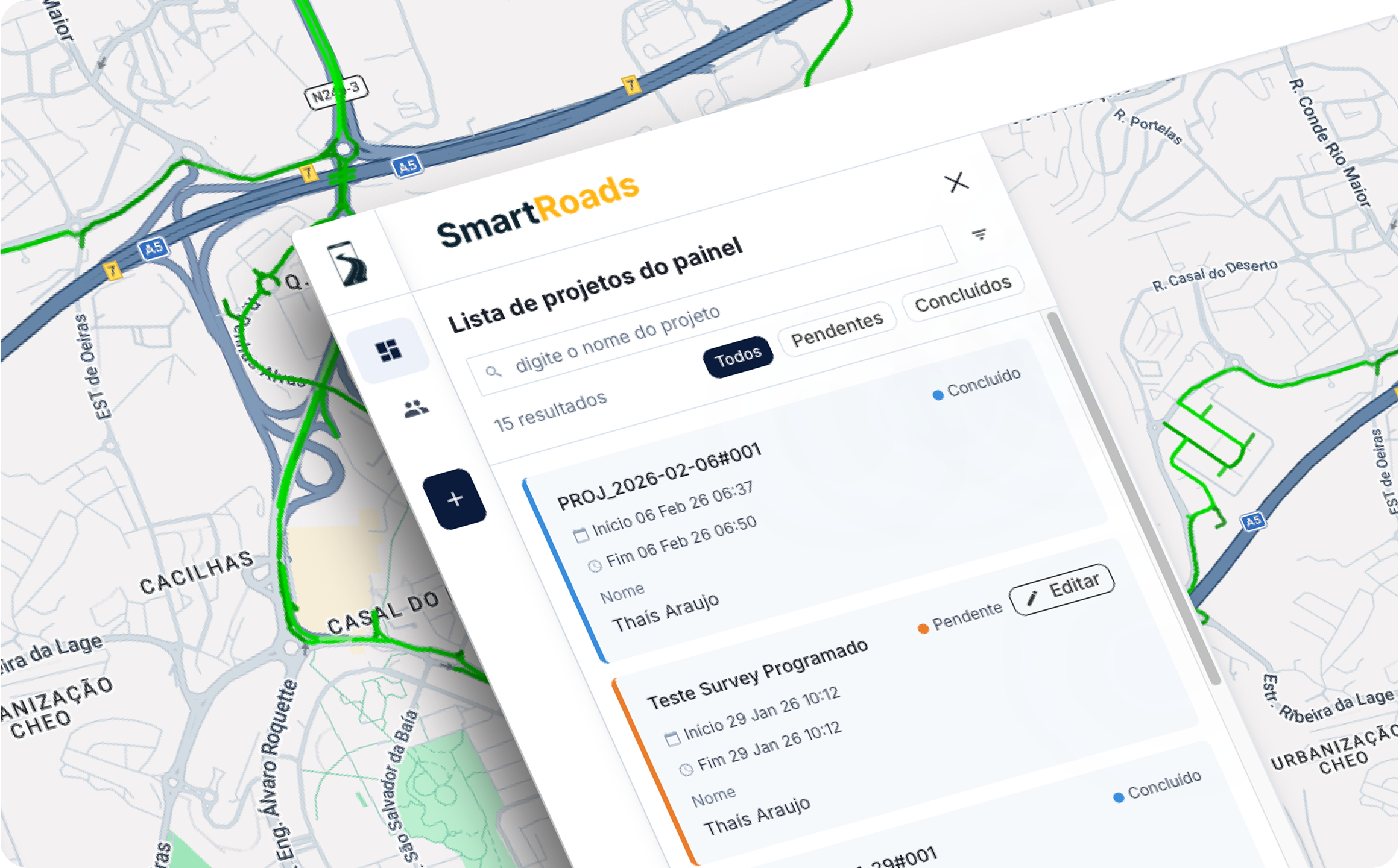
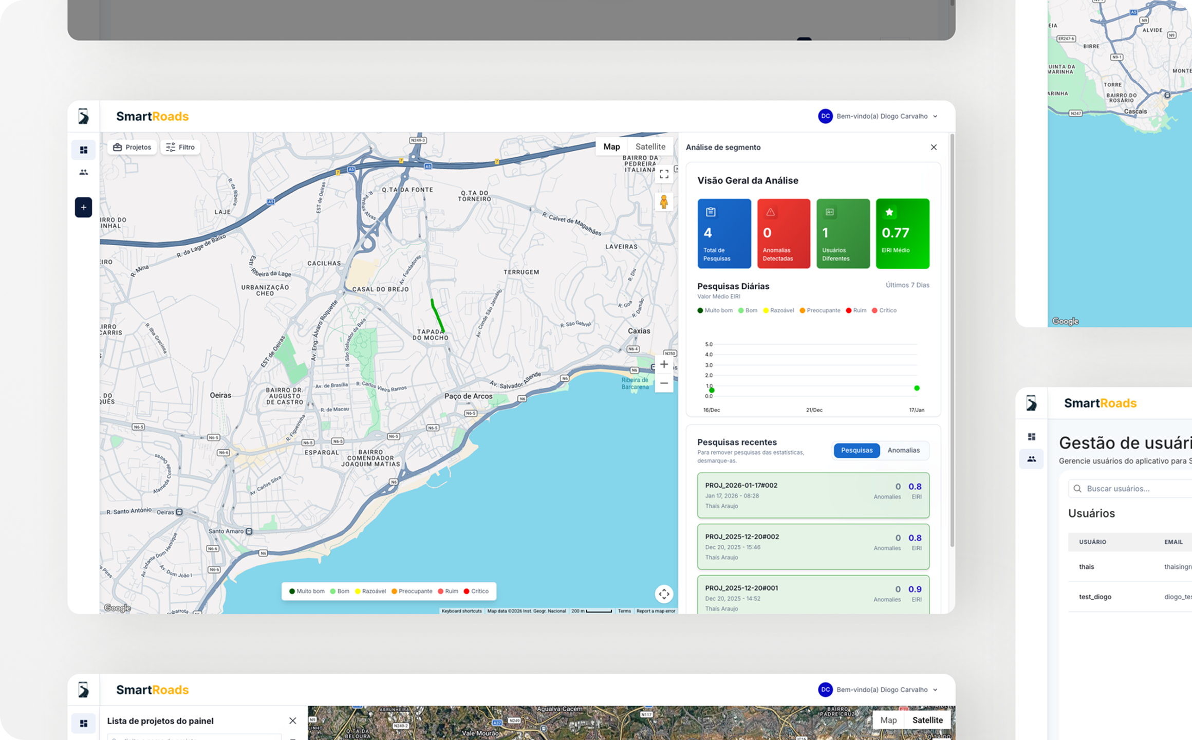
• A multi-tenant web dashboard was delivered, enabling organizations to create survey projects, manage entities and teams, visualize results, and monitor road condition analytics.
• The platform was designed with extensibility in mind to support additional infrastructure analytics modules in the future.
• Data Processing & Visualization
• Backend pipelines were implemented to compute road roughness indicators and generate segment-level insights.
• Interactive map-based dashboards provided clear visualization of road condition metrics and maintenance prioritization support.
Results
The Smartroads AI platform successfully transitioned from concept to operational product capable of supporting real-world pilot deployments.
Key outcomes included:
• Delivery of a fully functional offline mobile survey application implementation for scalable SaaS architecture supporting multiple organizations
• Creation of proprietary geospatial road network models
• Reliable processing of large volumes of sensor-based survey data
• Interactive visualization of road condition insights for infrastructure stakeholders
• Road readiness for pilot programs and field validation across Portugal
Conclusion
The Smartroads AI project demonstrates the impact of combining deep product ownership, geospatial engineering expertise, and scalable SaaS architecture when building infrastructure intelligence platforms.
By transforming a research-based use case into a production-ready system, the project enabled Smartroads AI to validate its technology in real operational environments and establish a strong foundation for future expansion into broader mobility analytics solutions.
End-To-End Product Delivery And System Architecture
Offline-First Android Survey Application
Geospatial Road Network Modeling (GeoJSON / Shapefiles)
Multi-Tenant SaaS Dashboard
Project And Survey Management Workflows
Sensor Data Ingestion And Processing Pipeline
Real-Time Visualization With Computation Logic
Interactive Map-Based Road Validation
Scalable Cloud-Ready Backend Architecture
Extensible Platform Design For Future Analytics Modules
Transform your vision into reality with our expert software solutions.